
| <prev< 9.6: From Napoli to Stromboli by ancient Hydrofoil |
| >next> 11.6: Stromboli conventional walk, hydrofoil to Salina |
10.8: Hiking around the island and ontop of volcano Stromboli
|
The commercial trekking companies gather tourists into groups, leaving Stromboli village in the afternoon. They all ascend to the crater via the northern route and are then sent back to the village along the eastern descent. The tourists are given protective face masks, but these are not intended to protect against volcanic gases. Instead, they are necessary because the large number of people raises dense clouds of dust when descending over the fine volcanic sand.
 Thus, it may be appropriate to look for an alternative access route. Watching the volcanic eruptions after sunset is, and will always remain, an extraordinary and memorable experience. Of course, if you feel comfortable in a large crowd of tourists, you are welcome to pay for a commercial trekking operator. Otherwise, a DIY approach may be the better choice, provided it is legal and permitted under current access regulations.
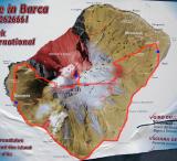
The route presented here avoids the problematic ascent via the eastern trails used by tour operators. In general, tour operators and volcano guards do not appreciate encountering independent hikers on the mountain. Our proposal, therefore, is to first enjoy the spectacular walk from Stromboli village to Ginostra along the southern coastline. It is not an easy walk, but if you are used to hiking in the Alps, for instance, it should not pose a serious problem. And the rewards are considerable.
In Ginostra, you wait until late afternoon, then climb the volcano from there, following a path that hardly anyone seems to use nowadays.
I assume that those undertaking the ascent on their own are aware of the associated risks and the equipment required, such as sufficient water, headlamps, and so on. Be aware that access above 400 m a.s.l. may be formally forbidden unless accompanied by authorised guides.
The volcano is usually gentle, but every now and then it may become more unpredictable for a couple of months before returning to its normal, friendly mode. Check the current situation online before you go.
 | I.) From Stromboli village to Ginostra along the southern coast line
|
| II.) Ginostra
|
In Ginostra, a charming (really charming) cluster of a few houses awaits you, including a church and a post office, all embedded in exactly the kind of Mediterranean vegetation one hopes to encounter. It may be a good idea to visit one of the two restaurants if necessary, thus sitting out the hottest hours of the day accompanied by a sequence of cappuccini.
| III.) From Ginostra to the crater of the volcano Stromboli
|
Since the idea is to reach the crater at sunset, a fairly well-thought-out schedule can make your day. We paid the bill at **5:55 p.m.** The path climbing Stromboli from Ginostra first leads north, then passes a fairly large solar power plant hidden among the bushes. After reaching the steep northern coast at **Punta d’u Curovu** at **6:20 p.m.**, the trail turns sharply east, and things become a little more complicated.
Because the entire volcano now seems to be officially off-limits, except when accompanied by paid guides, most of the trails are nowadays unused and therefore difficult to follow, with all sorts of nasty bushes obstructing your way. Do not try this in shorts; wear strong long trousers instead.
It is a pity that these trails are not maintained, all the more so since the whole area appears to be some kind of natural park, probably absorbing public subsidies. Interest in accurate terrain topography also seems not to be particularly well developed, since there are as many different trail indications as there are map publishers. Nor do local people seem to know much about the current state of their trails. Do not even try asking for a suitable trail — or ask the same question to at least two different people in order to receive two contradictory answers.
So what? Before leaving, consult Google Earth and your intuition.
As we continued our climb, at around **7:20 p.m.** the vegetation suddenly vanished, letting us enter a metaphysical, moon-like landscape. The first smoke ejections gave us a grand welcome. We reached the rim of the crater at around **7:55 p.m.**, just in time for the compulsory sunset scenography.
| IV.) The crater of Stromboli
|
From the english wikipedia: Stromboli is remarkable because of the length of time for which it has been in almost continuous eruption. For at least the last 2,000 years, the same pattern of eruption was maintained, in which explosions occurred at the summit craters with mild to moderate eruptions of incandescent volcanic bombs at intervals ranging from minutes to hours, something which proved a considerable tourist attraction. This characteristic Strombolian eruption, as it is known, is also observed at other volcanoes worldwide. Eruptions from the summit craters typically result in few second-lasting mild energetic bursts emitting ash, incandescent lava fragments and lithic blocks up to a few hundred meters high. Stromboli's activity is almost exclusively explosive, but lava flows do occasionally occur - an effusive eruption in 2002 was its first in 17 years.
The mildly explosive eruptions are also occasionally punctuated by much larger eruptions. The largest eruption of the last hundred years occurred in 1930, and resulted in the deaths of several people and the destruction of a number of houses by flying volcanic bombs. Large eruptions occur at intervals of years to decades, and the most recent large eruption began in 2002, causing the closure of the island to non-residents for several months. The eruption started with a lava flow (29 December 2002) along the "Sciara del Fuoco" flank that rapidly reached the sea. On 30 December 2002, a huge volume of rocks collapsed from the "Sciara del Fuoco" generating at least two landslides and many tsunami waves. The highest wave was 10 m high and caused serious damage at the Stromboli village. On 5 April 2003, a strong explosion from the summit crater ejected rocks that reached Ginostra village, damaging some houses. The eruption terminated on July 2003.
On 27 February 2007, two new craters opened on the island, with lava flowing into the sea from one of them.
| V.) From the crater downto Stromboli village
|